Urban Trek USA is an excellent resource for your San Francisco visit; providing self-guided directions for visitors to explore San Francisco like a long-time resident would, plus tips on whatever would be helpful to those who are visiting San Francisco.
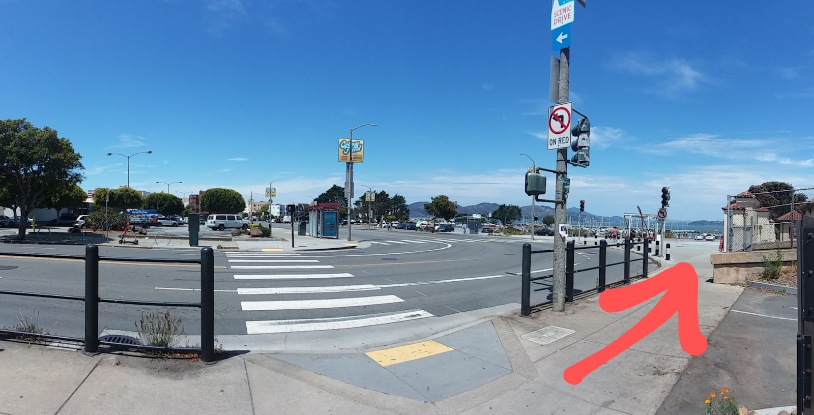
Coming from the upper part of Fort Mason, you can either take the stairs down (you cannot miss the stairs if you are on the paved path of the upper part of Fort Mason) or you can take the paved path to Laguna St and Marina Blvd. When you get to this point walk to the right:
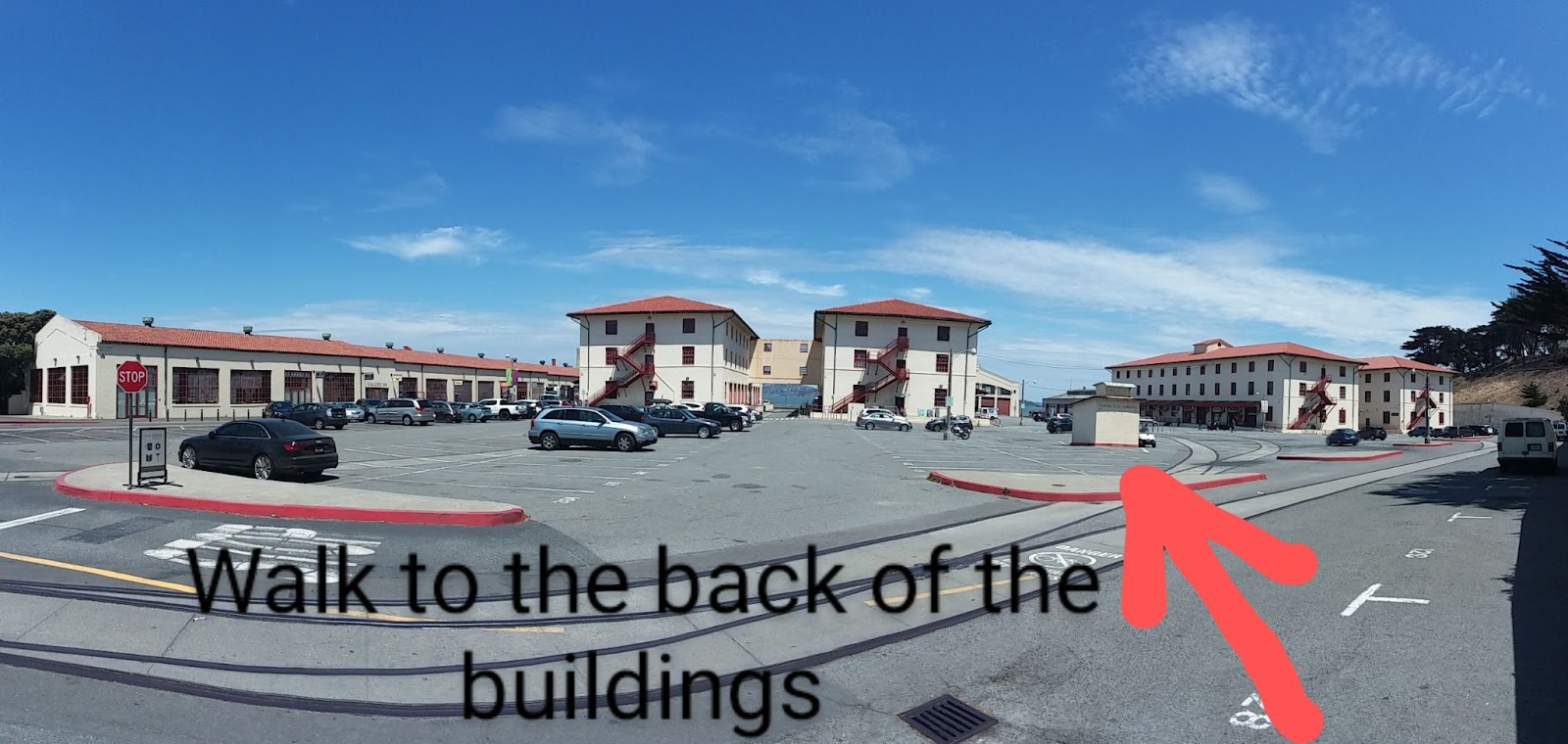
After you walk to the right, you will see the entrance to lower Fort Mason:
Then walk towards the last two buildings on the right and walk in between the second and third buildings (where the arrow is pointing):
You will then see the building of the San Francisco Art Institute:
Facing this building, walk to the right side
Walk to the back of this building using the walkway on the right side of the building:
When you get to the back, walk to the left and you will have this view:
Walk back to the front of the San Francisco Art Institute building by taking the walkway where the arrow below is pointing:
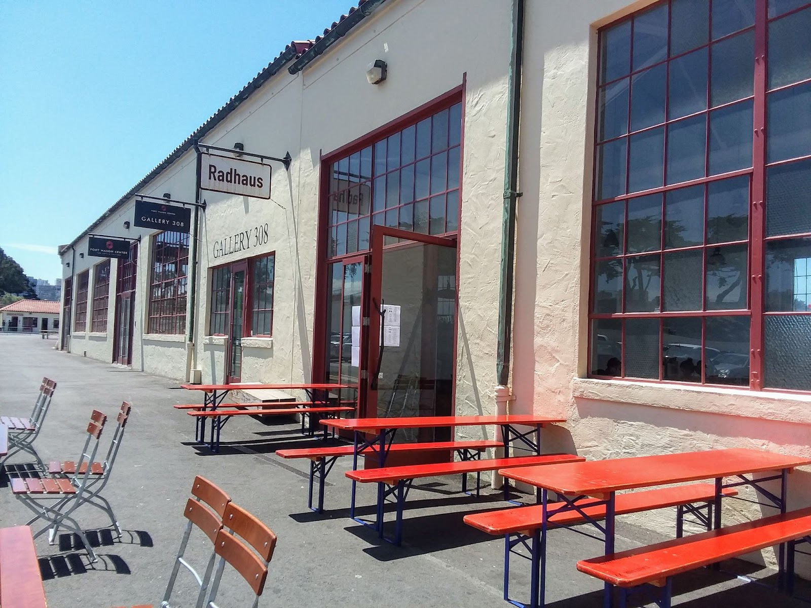
When you get back to the front of the San Francisco Art Institute building, turn right and when you get to the end of the walkway turn left. There are places to eat, have drinks and coffee if you want to stop and relax for a bit:
Greens is excellent especially if you are vegan/vegetarian
Radhaus has good German food, beer, wine & cocktails
Love the Radler
(Click photo to enlarge)
Beet salad goes well with the Radler
The view when sitting at the bar
Goody Cafe for coffee and casual fare
Note: If you need to use the toilet, these places will have one.
Special Notice: This part of San Francisco is usually windy. Therefore, the temperature will be colder than downtown or parts of San Francisco that are more sheltered from the wind. It will be a good idea to always dress in layers when exploring San Francisco.
To proceed to the Marina Green (click here for next tip), take this exit instead of walking all the way to the entrance:
This exit is right after the building where Radhaus is located
Note:Entire directions herein can be provided to you on PDF and Google Docs format upon request.
Update: As of April 1, 2022, Off the Grid at Fort Mason has resumed. This event is held every Friday from 5:00 pm - 10:00 pm. For 2022, the event will be held until November 11, 2022. There are a whole bunch of food trucks with some delicious food. Entertainment (i.e. music) is also part of the event. For more information about this event, click here to the event website.
These video and photos are from my visit on April 1, 2022:
(Note: I personally would do the Lands End Trail to Baker Beach to Batteries to Bluffs Trail to Golden Gate Bridge to Crissy Field to Marina Green to lower Fort Mason to upper Fort Mason. Or if you want to split into two, then Lands End to the Golden Gate Bridge and then upper Fort Mason to Crissy Field. The directions were done the way they are because most people are coming from the Fisherman's Wharf area and not the Lands End Lookout area.)
Updated to include newly opened (August 25, 2021) Black Point Historic Gardens
The second installment for things to do in San Francisco #TuesdayTips is (upper) Fort Mason. Fort Masonis just a place most visitors pass through when biking or walking to the Golden Gate Bridge from Fisherman’s Wharf. Therefore, most visitors just bike or walk along the main promenade and see the awesome view of San Francisco Bay, Alcatraz and the Golden Gate Bridge. However, there are three things that you should also check out:
The Fort Mason Community Garden is my favorite spot especially when the flowers are in full bloom (click here for history of the community garden). It is somewhat of a secret spot. I bring my lunch and sit at my favorite bench and just relax, admire the view and sometimes contemplate on how lucky I am to live in San Francisco and these surroundings. Click on this link to a prior post regarding the community garden.
The supposed haunted house, Haskell House. Read these two online articles:
The area near the Haskell House with a nice view, Black Point Battery.
Note: As seen in the video and photos, there usually is no crowd during the weekdays. However, on weekends and holidays, Fort Mason turns into “Frat Mason.” As this nickname suggests, the Grand Meadow is crowded with a party atmosphere as noted by this SFGate article.
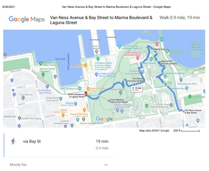
(Click to enlarge map)
How to get to Fort Mason via Muni bus from downtown:
Take the outbound Muni #30 bus and disembark at the bus stop at Van Ness & North Point / Bay Streets. (Note: This is the stop right after North Point & Polk so make sure you pull the cord by the window or press the red button to request a stop.)
There is an entrance gate at the corner of Van Ness & Bay Streets (refer to map above). When you enter the gate, just follow the sidewalk until you reach the tennis court and you will see the Commanding General house:
(Click to enlarge photo)
Walk through the driveway around the small rotunda until you get to the top and walk right:
(Click to enlarge photo)
(Click to enlarge photo)
When you see the big tree in front of you, walk towards it and you will have your first awesome view of the area:
(Click to enlarge photo)
(Click to enlarge photo)
After, go back to the paved path until you get to this fork follow the paved path to your left: (Note: The reason for walking left instead of going straight is so you can do a complete circle as see the best parts.)
(Click to enlarge photo)
Keep walking along the paved path towards the house with the red roof, Haskell house:
(Click to enlarge photo)
When you get to Haskell house, stop to see if you feel any ghostly presence as this house is purported to be a haunted house: (Note: Refer to two links at the top of this page about articles on this house.)
(Click to enlarge photo)
Continue walking on the paved path until you reach this point and walk right:
(Click to enlarge)
Walk down to the Historic Gardens: (Note: Since this place just opened on August 25, 2021, the flowers and plants are not yet fully grown but will be awesome in the near future.)
(Click to enlarge)
When you get to this point where there are stops down, go down and then up the other side. (Note: Do not walk left as that will lead you to Aquatic Park.)
(Click to enlarge photo)
Continue on the paved path until you reach the stairs that will take you back to the top:
(Click to enlarge photo)
(View from top of stairs. Click to enlarge photo.)
When you get to the top of the stairs, you have walked around so walk right on the paved path back towards Haskell house and keep walking on the paved path and walk straight ahead instead of walking right earlier:
(Click to enlarge)
The paved path will lead you to Black Point Battery. You will have a better view of Alcatraz as you walk along the paved path. When you get to the stairs, go up the stairs and walk right towards the old cannon:
(Click to enlarge)
(Click to enlarge)
(Click to enlarge)
There will also be a nice view when you get to where the cannon is located:
When you get to the end of the dirt path and reach the paved road, make a right and walk toward the small street, Bunker Rd., and turn left:
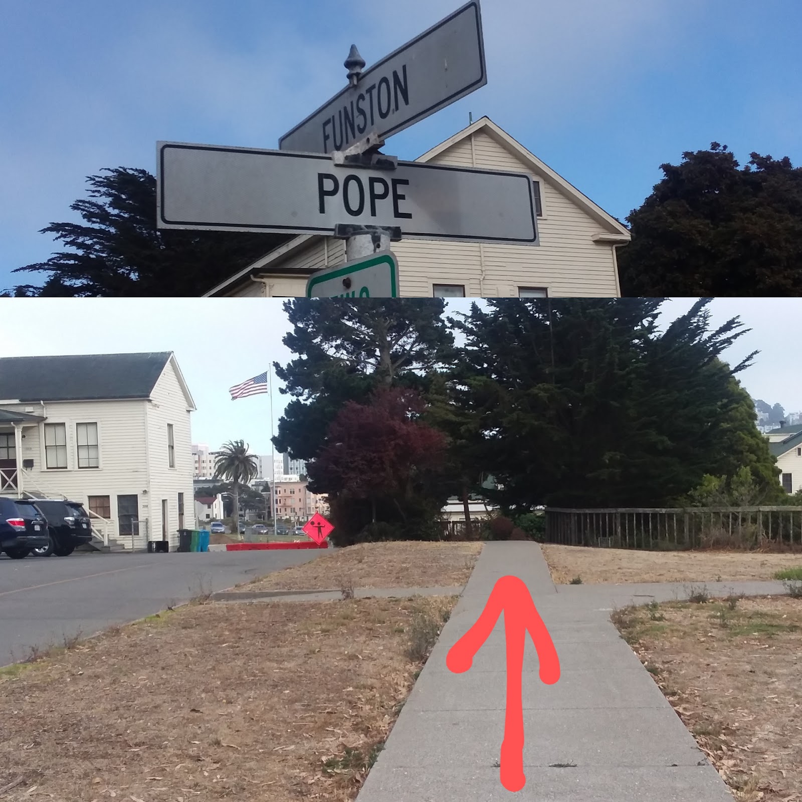
When you pass the hostel building at the top of the Bunker Rd turn left on Funston and turnright on Pope:
When you see the yellow fire hydrant, turn right to the gate of the Fort Mason Community Garden:
(Enter the gate. Click to enlarge photo.)
After you enter the community garden, turn right:
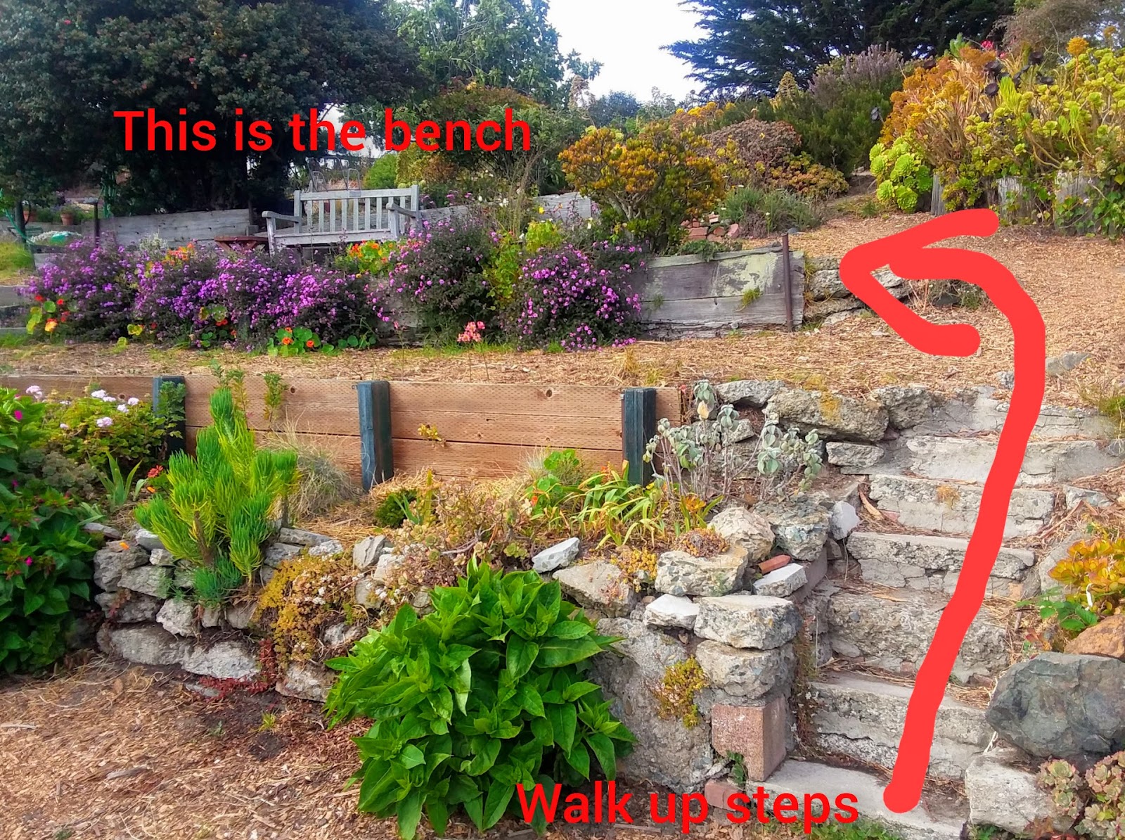
When you see these steps on your right, go up and walk towards the bench:
The bench is my favorite spot because it is a quiet spot and has a nice view
This is the view from my favorite bench
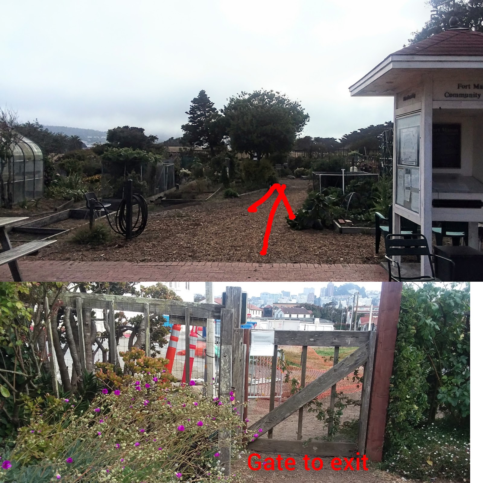
Have a look around and enjoy the colorful flowers and beautiful peaceful surroundings. When you want to leave, go back to the area where you entered and walk to the other side where there is a small gate:
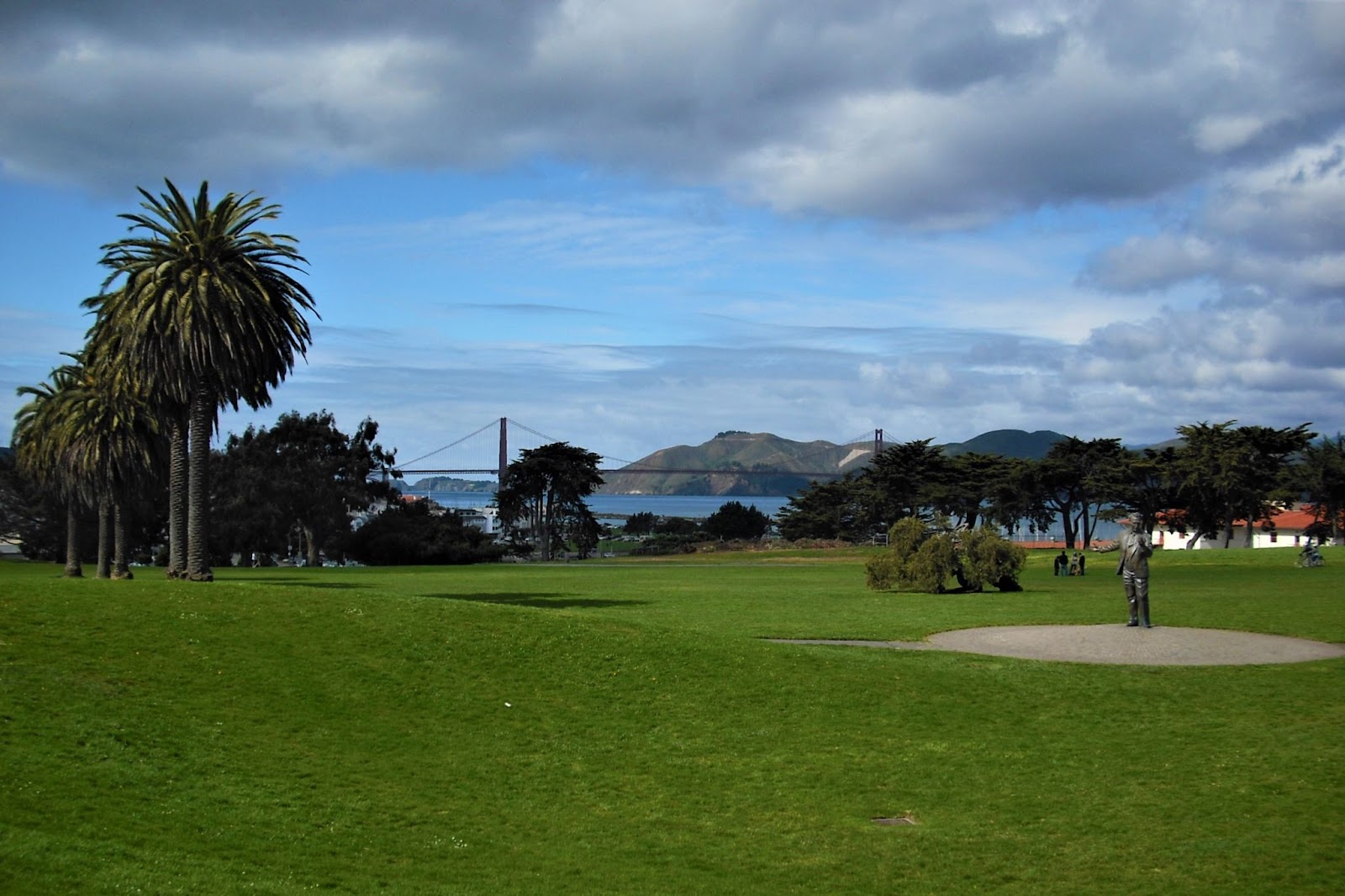
After you exit, walk straight ahead and when you get to the top of the mound, you can walk toward the statue of John Burton where there will be a nice view of the Great Meadow and the Golden Gate Bridge:
.
Note: There is a public toilet not to far from the John Burton statue if you need it.
Next, walk toward the bay and you will see lower Fort Mason below and more nice views.
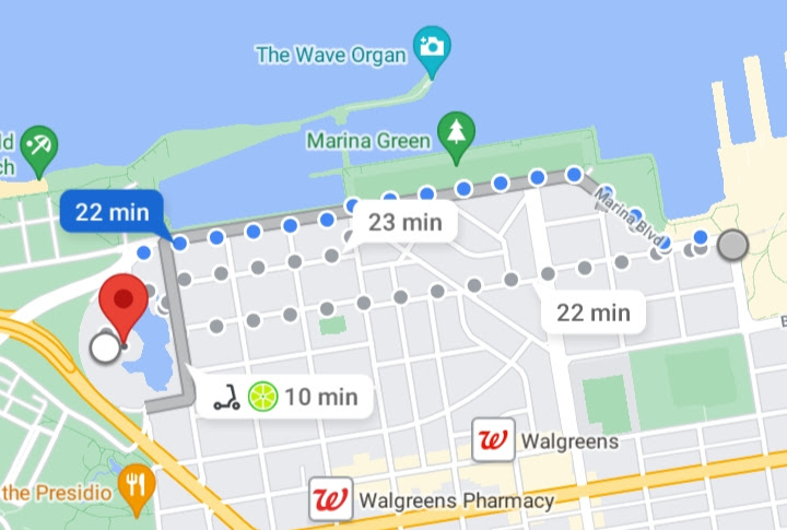
Follow the paved path and walk in the direction towards the Golden Gate Bridge. The path will lead you to the Marina Green. If you keep walking, you will pass the Palace of Fine Arts (refer to Google map below showing about 1.1 miles, 22 minute walk):
You can then walk to the East Beach in Crissy Field (refer to Google map showing 1/3 mile, 7 minute walk:
You can then walk to the Golden Gate Bridge (refer to Google map showing 1.7 miles, 37 minute walk):
In the future, I will do another Tuesday Tips on Crissy Field and my favorite spots there and the path I recommend taking to the Golden Gate Bridge. And also stuff to do in lower Fort Mason.
Enjoy!
Public transportation at Crissy Field:
As of July 26, 2021, only the Muni #30 bus goes to Crissy Field. The Sports Basement parking lot is the end of the line for outbound and the starting point for the inbound buses. Other bus stops in or close to Crissy Field are: Mason St & Halleck St and Mason St & Yacht Rd.
Note: As of July 26, 2021, there are no Muni buses that go to the Presidio Transit Center. In the past, the Muni #43 did. Maybe it could be restored. In the past the outbound #43 went to the Haight neighborhood and the inbound went to the Marina neighborhood / Fort Mason.
Note:Entire directions herein can be provided to you on PDF and Google Docs format upon request.
(Note: I personally would do the Lands End Trail to Baker Beach to Batteries to Bluffs Trail to Golden Gate Bridge to Crissy Field to Marina Green to lower Fort Mason to upper Fort Mason. Or if you want to split into two, then Lands End to the Golden Gate Bridge and then upper Fort Mason to Crissy Field. The directions were done the way they are because most people are coming from the Fisherman's Wharf area and not the Lands End Lookout area.)