Urban Trek USA is an excellent resource for your San Francisco visit; providing self-guided directions for visitors to explore San Francisco like a long-time resident would, plus tips on whatever would be helpful to those who are visiting San Francisco.
Showing posts with label Tuesday-Tips-Coast. Show all posts
Showing posts with label Tuesday-Tips-Coast. Show all posts
Note:On the video, there is a message when you see the photo below to watch a video about this amazing discovery:
(Click to enlarge photo)
It was thought that the Franciscan Manzanita was extinct in the wild until someone discovered this plant in the Presidio before the old Doyle Drive was to be demolished and replaced by the Presidio Parkway. Click on this link to the YouTube video by Melissa Peabody documenting the amazing set of circumstances ("divine intervention" as said by one person in the documentary video) that lead to saving the Franciscan Manzanita from being extinct: Click here for the link to YouTube video
The Presidio has a whole lot of excellent vistas and now everyone has to definitely add Battery Bluff Park to the must things to do in San Francisco as the video below shows:
How to get to the Presidio (eco-friendly way):
Coming from downtown, the best way to get to the Presidio is to take the FREE PresidiGo Downtown shuttle from one of the three stops: Howard & Beale, Drumm & California (near Embarcadero BART station), Van Ness & Union. The PresidiGo Downtown shuttle departs every 30 minutes.
The most convenient PresidiGo shuttle stop downtown is the one on Drumm & California at shown in this photo:
(Click on photo to enlarge)
How to get to Battery Bluff from Presidio Terminal:
Disembark at the Presidio Terminal (last stop in the Presidio).
Follow the Presidio Promenade by walking in between the two buildings as shown in the arrow in this photo:
(Click to enlarge photo)
The Presidio Promenade will lead to the Presidio National Cemetery. Once you get there, you will see the entrance to Battery Bluff as shown in the video at the bottom of this page. (Note: The video at the bottom will show you exactly what you will see if you follow these directions.)
Follow the paved path when you enter Battery Bluff. You will immediately see an awesome view as shown in the video.
After a little bit of walking, you will see a paved path to your left (as shown in the photo below):
(Click to enlarge photo)
Turn left and follow the path (shown above) until you see steps on your left leading to the picnic tables at the top. This is a panoramic view from the area where the picnic tables are located:
(Click to enlarge photo)
(Click to enlarge photo)
Follow the path where the picnic table are located and walk towards the direction of the Golden Gate Bridge until you see the bench shown in the photo below:
(Click to enlarge photo)
The spot shown above is another vantage point. Walk back to the picnic tables and when you see steps on your left leading to the lower path, go down the steps and make a left at the bottom and follow the path as shown in the photo below:
(Click to enlarge photo)
Follow the path shown above towards the Golden Gate Bridge until you get to the overlook as shown in the photo below:
(Click to enlarge photo)
You can make your way back to the entrance by taking the path at the lowest part of Battery Bluff. From the overlook, turn left as shown in the photo below:
(Click to enlarge photo)
The path shown above will lead you back to the entrance on Lincoln Blvd.
Do not miss:
The views are definitely the main attraction. However, do not miss reading the story boards along the path:
(Click to enlarge photo)
If you follow the directions above, this video shows what you will see:
Public toilets: The closest public toilet is at the Transit Center near the Main Post, which about a 10-minute walk from Battery Bluff. For a list of other public toilets around the Presidio, click on this link to the Presidio website.
Tips:
Even though it is sunny, this area can get windy and that means the temperature will be much cooler than other parts of San Francisco (e.g. downtown).
It is always a very good idea to dress in layers so you can add or remove pieces of clothing as the temperature changes. A hooded sweatshirt can be your best friend in San Francisco.
As a rule, it is usually windier in the afternoon than in the morning. However, when there is fog, is is usually foggier in the morning and the fog burns out in the afternoon after 12:00 pm.
Enjoy!
Coming next will be how to walk to the Pet Cemetery and the Golden Gate Bridge.
This installment of things to do in San Francisco #TuesdayTips as part of #UrbanTrekUSATips features Crissy Field. Today, in addition to tips on Crissy Field, this post also includes how to walk to the Golden Gate Bridge and see one on Urban Trek USA's secret spots.
(Update March 8, 2022)
This video is an update after I took photos on a gorgeous clear day. San Francisco does not always have clear skies, especially during summer, so I am leaving the original video below with photos showing a bit of fog to give viewers a more realistic expectation.
This is the original video with some photos showing some fog.
Crissy Field usually is a place were bikers pass when biking to the Golden Gate Bridge. However, I think bikers miss the essence of what Crissy Field has to offer when simply biking and not walking the promenade in Crissy Field. I am a firm believer that walking is the best way to experience a place. (Note: One of the best memorable experience I had was when children that was part of my urban trek saw a baby sea lion (or seal?) distressed and would not leave until we made sure the pup would be okay. I had to call the Marine Mammal Center and we waited until the volunteers came to rescue the pup. If we were not walking this experience would not have happened.)
East Beach is where most people hang out. If you walk farther towards the Golden Gate Bridge, my favorite spot is where the benches are (shown below) because it is quieter and less crowded so you can enjoy the scenery and tranquility of the place. (Note: There are public toilets in East Beach if you need to use them.)
(When walking along the promenade, you see these cluster of Cypress Trees, walk towards the beach. Click to enlarge the photo.)
(The benches are my favorite spot. Click to enlarge the photo.)
(This is the view from my favorite spot. Even on a somewhat foggy day, it's still awesome.)
(Update March 8, 2022)
On a clear day, it's spectacular!
After, keep walking to toward the Golden Gate Bridge. When you get to the Warming Hut, that would be another spot to admire the views of the Golden Gate Bridge and The City.
(This is the Warming Hut. Click to enlarge the photo.)
(This is the view form the Warming Hut.)
The Warming Hut offers nice souvenirs and also good fast food. (Note: There are public toilets near the Warming Hut if you need to use them.)
After you walk past the Warming Hut and the public toilets, you should see this pedestrian crosswalk and stairs:
(Cross to the other side and go up the stairs. Click to enlarge the photo.)
When you get to the top of the stairs, walk to your right:
(Walk to the right at the top of the stairs. Click to enlarge the photo.)
These benches would be a good spot to take seat and rest and enjoy the view:
This is a video taken along the paved paved path after passing the benches so make sure to look back after you make a turn around the bend:
March 8, 2022 update
Keep walking on the paved path until you see this sign and walk right and follow the dirt path:
(This is the sign mentioned above and the dirt path. You will see this dirt path when the paved path ends <click to enlarge the photo>. Do NOT continue on the paved path because you will miss the secret spot.)
You will then see this entrance to a short tunnel:
(This is the entrance to the tunnel. Click to enlarge photo.)
Please make sure you crouch down when you see this warning because the other end of the tunnel is low and you do not want to bump our head:
(Click to enlarge photo.)
When you exit the other side of the tunnel, you will have a nice view of the Golden Gate Bridge and there will be two picnic tables for you to sit and rest or admire the view or a perfect spot to have lunch/snack.
(Click to enlarge photo.)
(Click to enlarge the photo.)
(Click to enlarge the photo.)
After, walk up the paved path that leads to the Golden Gate Bridge. Most people will be at this vista area which is usually crowded., In my opinion, my old secret spot has a better angle for a better photo and without the crowd.
(Don't you think the view from my old secret spot <above> is better than this where most people are?)
Keep following the paved pedestrian and biker's trail toward the Golden Gate Bridge. If you want to proceed walking to the Batteries to Bluffs Trail, walk under the bridge following the Coastal Trail and then follow the directions detailed in the Batteries to Bluffs post.
(Note: I personally would do the Lands End Trail to Baker Beach to Batteries to Bluffs Trail to Golden Gate Bridge to Crissy Field to Marina Green to lower Fort Mason to upper Fort Mason. Or if you want to split into two, then Lands End to the Golden Gate Bridge and then upper Fort Mason to Crissy Field. The directions were done the way they are because most people are coming from the Fisherman's Wharf area and not the Lands End Lookout area.)
This installment of things to do in San Francisco #TuesdayTips as part of #UrbanTrekUSATips features Baker Beach. Today actually has two tips but since I had previously posted about the Batteries to Bluffs Trail, I just updated that post and am adding this post on Baker Beach. Check out the Batteries to Bluffs Trail post as it complements Baker Beach.
Baker Beach is pretty well-known except maybe that there is a section of Baker Beach (closest to the Golden Gate Bridge) that is clothing optional. Therefore, if you have children you do not want to expose to nudity then be aware. If you like to sunbathe without clothing then this is one of the spots in San Francisco that allows you to do so (also refer to Marshall's Beach <see video towards the very bottom below> in the Batteries to Bluffs Trail post).
Baker Beach has an awesome view of the Golden Gate Bridge. The water is pretty much ice cold so swimming is not what most people do. Also the currents are very strong so be very careful when wading in the water.
In a prior #TuesdayTips post that I did on Lands End Trail, I mention one can walk from the Lands End Trail to Baker Beach and provided directions to do so. Therefore, if you want to walk to the Lands End Trail from Baker Beach, simply do the directions I provided previously in reverse order.
(Note: Public toilets are available in Baker Beach)
From Baker Beach you can also walk to the Golden Gate Bridge via the Coastal Trail. If you are fit, I recommend taking the Batteries to Bluffs Trail to get to the Golden Gate Bridge. By fit I mean you will have to go down a whole lot of steps and then have to go up a whole lot of steps on the other side. Also, the trail is narrow and a bit rocky. A few steps on the stairway are a little loose so be CAREFUL especially when going down the stairs.
To get to the Batteries to Bluffs Trail, walk up the path shown in the photo below. This is just before or just where the nude sunbathers are located.
(Click photo to enlarge)
If you do not want to walk close to where the nude sunbathers are located, take the path by the old batteries as shown in the photo below.
(Click photo to enlarge)
When you get to the part in the photo shown below, walk up the path.
(Click photo to enlarge)
When you get to the top where Lincoln Blvd. is (Coastal Trail), make a left until you see the sign in the photo below.
(Note: When walking from Baker Beach towards the Golden Gate Bridge, this sign is facing a little bit the other direction so make sure you are looking for this sign on your left side.)
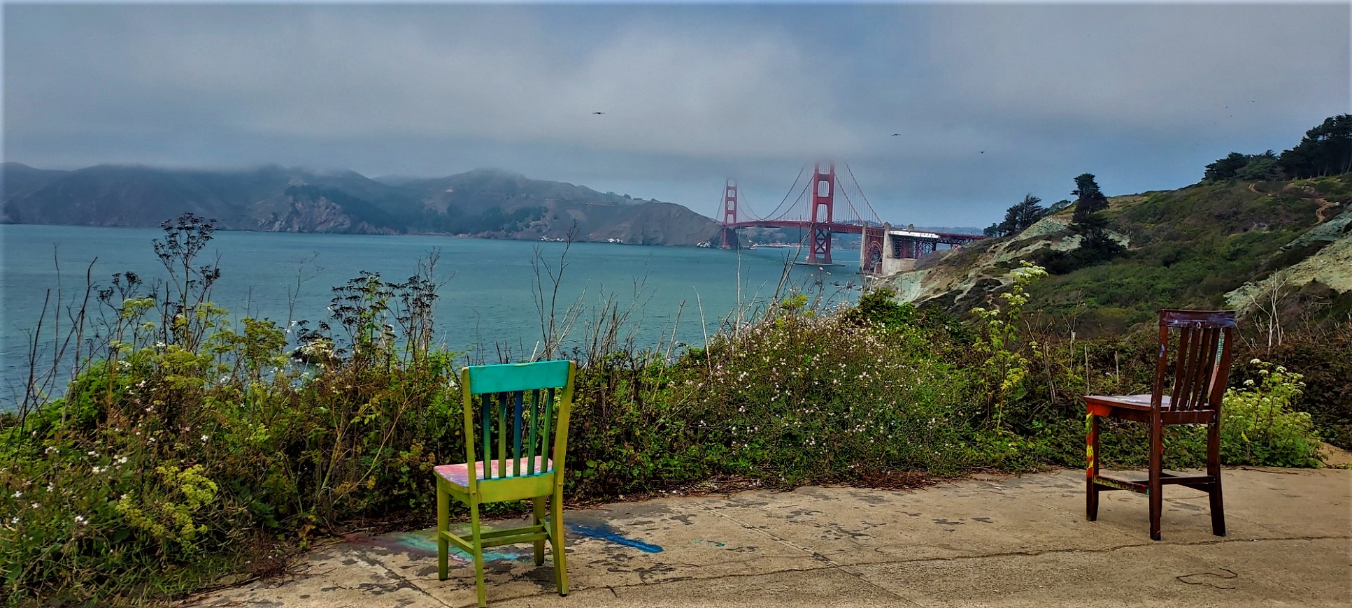
Walk down the stairs and stop whenever you want to admire the beautiful view. If these chairs are still on one of the old batteries, check them out:
(Click photo to enlarge)
Also, this is very interesting about the field note for this area:
(Note: For more information about the field notes in various places in the Presidio, click here.)
If you want to visit Marshall's Beach, watch out for the sign in the photo below and walk down the path.
(Click photo to enlarge)
Note: As mentioned earlier, Marshall's Beach is a clothing optional beach.
From Marshall's Beach, backtrack to the Batteries to Bluffs Trail and make a left and go up the steps. Before you get to the top, stop by this bench that you will see on your left (a little bit hidden) that has a pretty nice view:
(Click photo to enlarge)
After, walk up to the top where the Coastal Trail meets the Batteries to Bluffs Trial. Turn left on the Coastal Trail, which will lead you to the Golden Gate Bridge.
(Note: I personally would do the Lands End Trail to Baker Beach to Batteries to Bluffs Trail to Golden Gate Bridge to Crissy Field to Marina Green to lower Fort Mason to upper Fort Mason. Or if you want to split into two, then Lands End to the Golden Gate Bridge and then upper Fort Mason to Crissy Field. The directions were done the way they are because most people are coming from the Fisherman's Wharf area and not the Lands End Lookout area.)
Marina Green just like Fort Mason (refer to prior #TuesdayTips post) are places most visitors pass through when biking or walking to the Golden Gate Bridge from Fisherman’s Wharf. Therefore, most visitors just bike or walk along the main promenade and see the awesome view of San Francisco Bay, Alcatraz and the Golden Gate Bridge. However, there is a spot that has an awesome 360 degree view as this video shows:
Note: It can be windy here so I left the sound on to show it.
This spot is where the wave organ is located. The wave organ itself is not really worth visiting (in my opinion) since there is no sound unless it is really windy and the waves are strong. However, it is worth walking or biking to this spot because of the view it provides. It looks like you are on a small island in the middle of San Francisco Bay.
If you are with small children, it also has a beach spot that will be less wavy since it is a little sheltered:
Other things you will see in the Marina Green in addition to the above noted spot:
An outdoor gym
Parcourse
Dynamo Donut (awesome donuts) - Wednesday to Sunday
These directions take into consideration you are starting from lower Fort Mason (previous Tuesday Tips post) and exited the small gate in said directions.
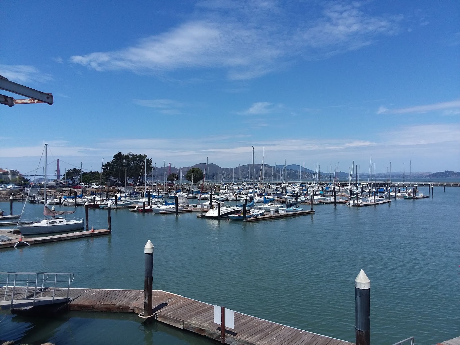
When you exit that small gate, you will see this marina:
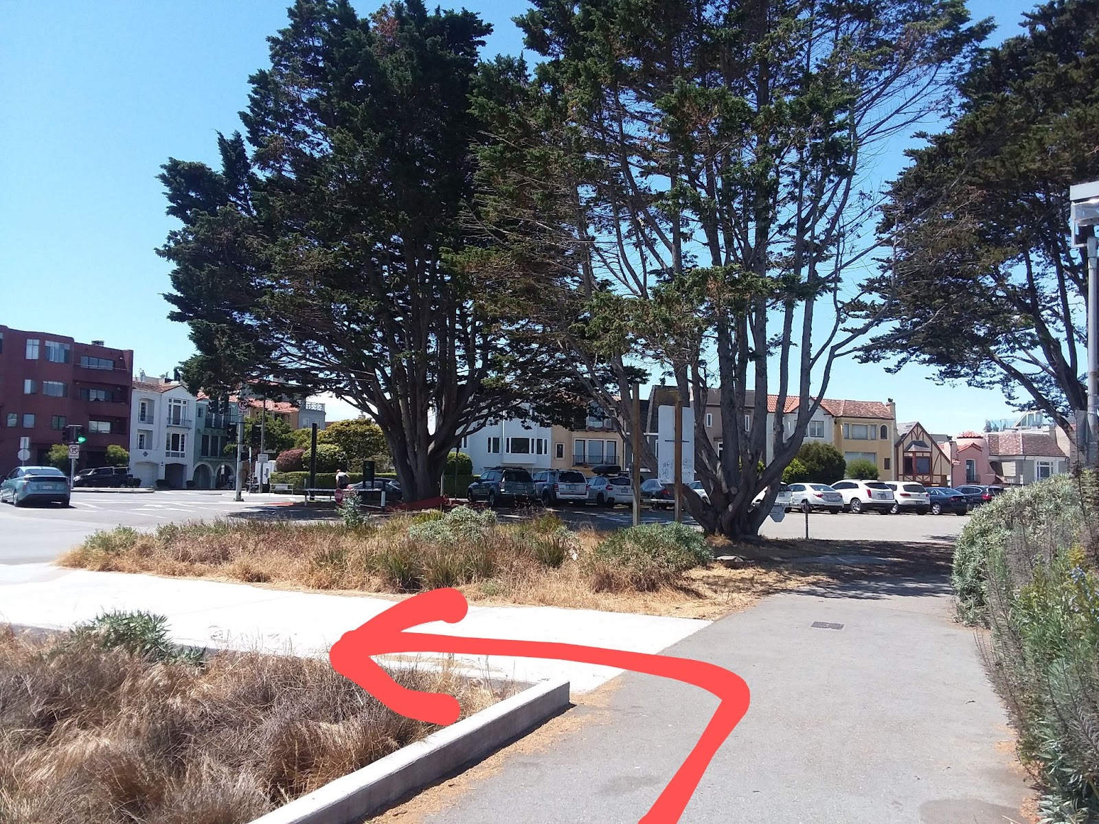
Keep walking until you get to this point (just before the parking area):
Go left as shown by the arrow so you are walking toward the Safeway Supermarket
When you get to the sidewalk, walk right and cross to the other side:
When you cross to the other side, you will see the outdoor gym and Parcourse:
The Marina Green is a popular place for joggers, people who want to exercise outdoors, and children playing soccer.
Note: There is a public toilet in that small concrete building not too far from the outdoor gym if you need to use it.
Keep walking along the path but be careful with the bikers and scooters as you are on a shared pathway.
When you get to this crosswalk, cross to the other side and walk right:
Keep walking until you get to the walkway by the water
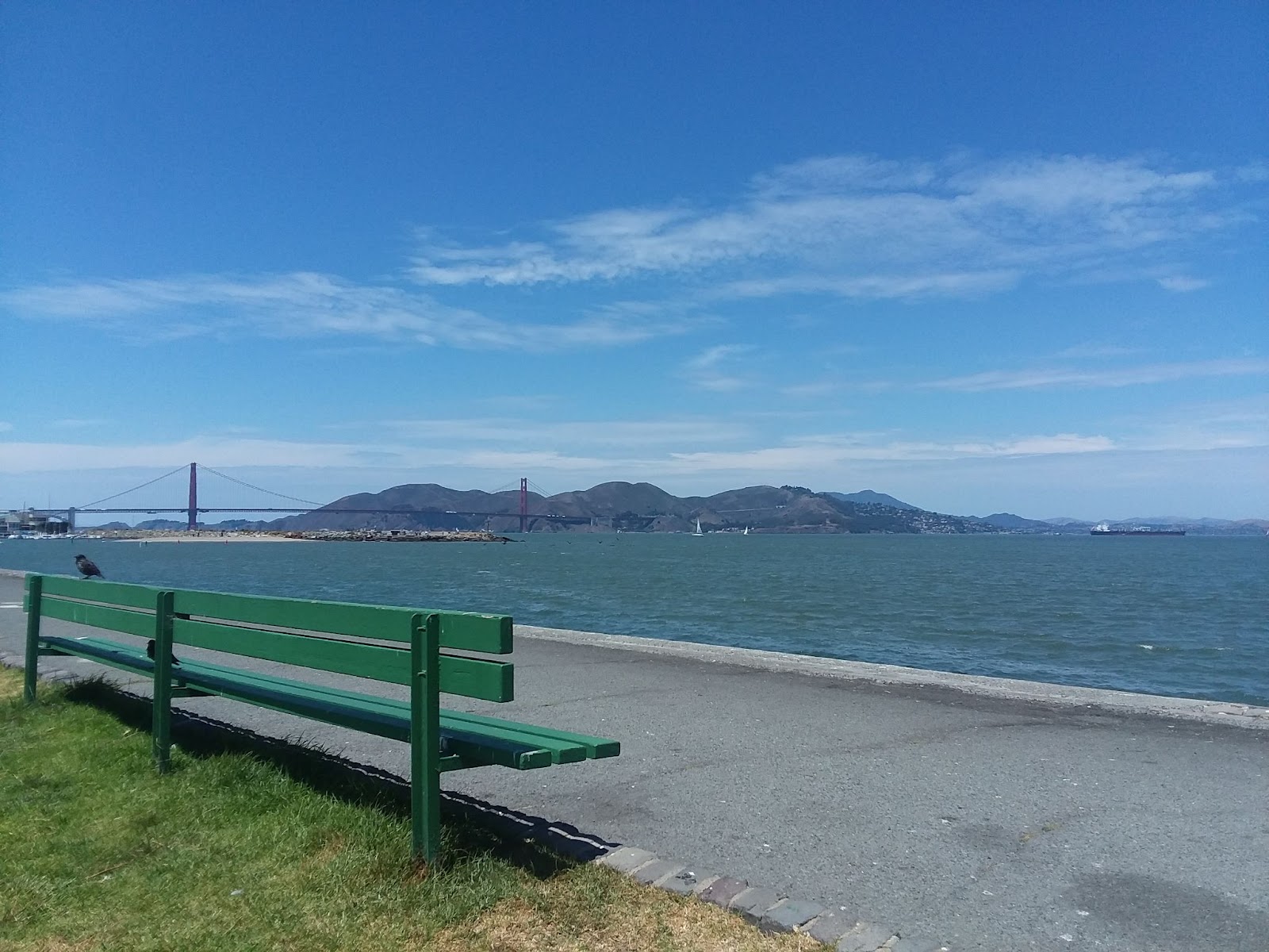
There are benches by the water so you can sit and take in the view:
Keep walking towards the Golden Gate Bridge until you have no choice but to walk left towards Marina Blvd. When you get to this point at Marina Blvd, walk right and take the part of the path closest to the water so you do not have to worry about the bikers and scooters:
Keep walking until you get to this point and walk right: (Note: If you later want to go to the Palace of Fine Arts, it is across the street on the left.)
After you walk right, look for this small kiosk for Dynamo Donuts, which is a super good donut spot and they have interesting flavors:
Note: There is a public toilet across the grass/field from the Dynamo Donut kiosk in case you need to use it.
When you get to this fork in the walkway, take the right side:
Keep walking toward the water and walk right when you get to the parking area for the St. Francis Yacht Club:
Keep walking until you get to the wave organ at the end of the walkway:
View facing south (towards The City) from the wave organ location
When you have had enough, walk back to the Sir Francis Yacht Club:
When you get to the St. Francis Yacht Club, you can proceed to Crissy Field and the Golden Gate Bridge or go to the Palace of Fine Arts first.
Enjoy!
Note: Entire directions herein can be provided to you in PDF and Google Docs format upon request.
(Note: I personally would do the Lands End Trail to Baker Beach to Batteries to Bluffs Trail to Golden Gate Bridge to Crissy Field to Marina Green to lower Fort Mason to upper Fort Mason. Or if you want to split into two, then Lands End to the Golden Gate Bridge and then upper Fort Mason to Crissy Field. The directions were done the way they are because most people are coming from the Fisherman's Wharf area and not the Lands End Lookout area.)